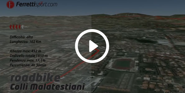
the Malatesta Castles
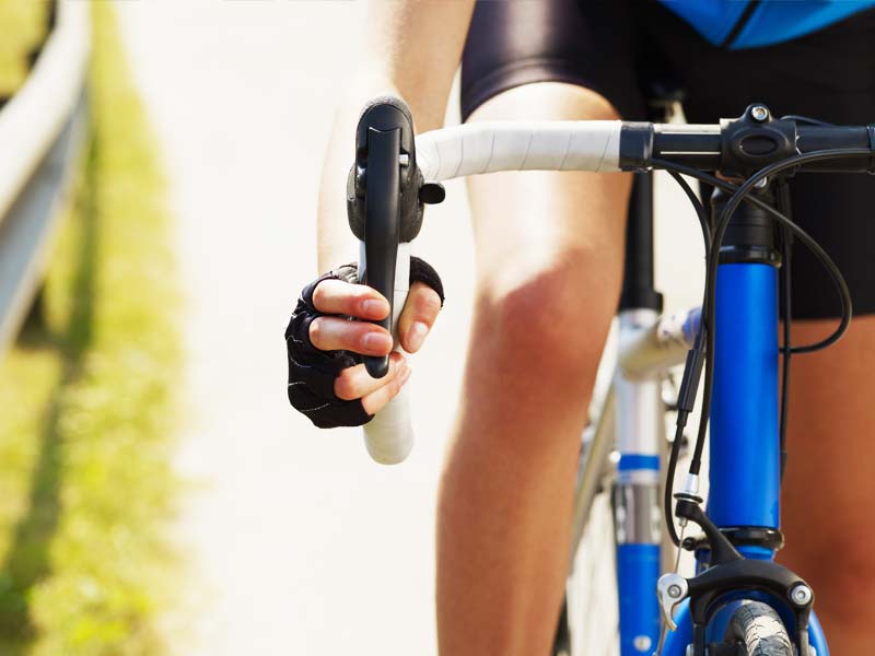
Type : Road Bike
Itinerary info
Technical data
Length
101 Km
Maximum height
452,8 m
Total difference in altitude
1850 m
Duration
4h 30m
Maximum incline
17,1 %
Assessment
Track Rank
Fun
Landscape
Condition
Technique
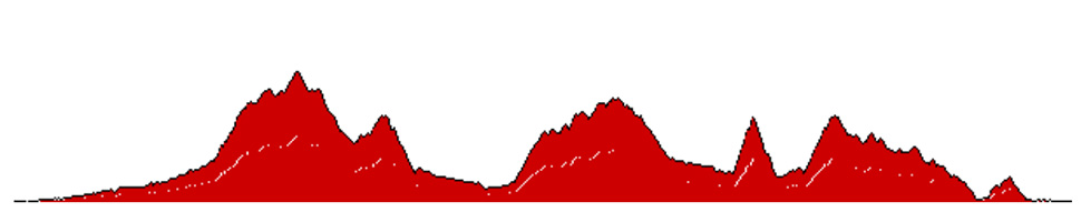
This itinerary is the so-called "short route" of the well-known local cycling competition called "the Malatesta castles", which is over 100 Km long and requires at least 4 hours of cycling at a good pace, considering the difference in altitude (2000 metres). The trail weaves through areas steeped in local history and which are all dominated by perfectly-maintained castles, which represent the legacy of the Malatesta family.
The itinerary starts at the hotel and cuts through Rimini in the direction of Ospedaletto/Lake Faetano along Marano road. The route is fast, traffic is light and it constitutes a great warm up, as the difference in altitude is only 100 metres over a 15 km stretch.
After these first 15 km, you enter the Republic of San Marino by climbing up the crest: you’ll see San Marino’s three Castles and almost reach their feet.
Details of the San Marino ascent 467 m a.s.l.
Total difference in altitude: 744 metres in 17.9 Km. Average incline: 4.9% Max incline: 19.6% Ascent time: 48 mins
The route up to Borgo Maggiore has an average incline of 10%. From 450 metres a.s.l., you turn towards Ventoso and back to Italy on an 8 km descent, at the end of which you turn towards Verucchio, another gem of the Romagna countryside (the fountain is located on the side of the piazza).
After crossing Verucchio’s historic centre, it's downhill to the Valmarecchia, passing by Torriana and then reaching Poggio Berni in a slight descent.
Details of the Sogliano al Rubicone ascent 339 m a.s.l.
Total difference in altitude: 388 metres in 10.7 Km. Average incline: 4.5% Max incline: 16.5% Ascent time: 33 mins
Past Camerano, you continue on towards Sogliano al Rubicone; this road is one of the most travelled by local cyclists. The 13 km stretch – with an average incline of 5% and peaks of 14% - goes through the town. You’ll reach Sogliano al Rubicone at 350 metres a.s.l.; this is an essential pitstop to fill up your water bottle at the fountain in the centre of the town.
Details of the Torriana ascent 291 m a.s.l.
Total difference in altitude: 202 metres in 2.3 Km. Average incline: 8.6% Max incline: 18.3% Ascent time: 33 mins
The trail continues, looping back with a long and entertaining downhill descent which goes past Torriana once again, up to Verucchio and deviates towards Rimini from the "Cantelli" area, where you take the so-called "Coste di Sgrigna".
The "coste" is a trail approximately 14 kilometres long which runs along the watershed protection between Valmarecchia and the Valley towards San Marino; it is almost entirely downhill, it is fast and well-paved. It is possible to enjoy a wonderful view of the Romagna coastline from its hairpin bends and on the road that leads back to the hotel.
Details of the Verucchio ascent 299 m a.s.l.
Total difference in altitude: 246 metres in 3.1 Km. Average incline: 7.9% Max incline: 15% Ascent time: 14 mins